The capital city: Kuala Lumpur
The longest river: Rajang (760 km in the Sarawak region)
The largest lake: Kenyir (the largest artificial lake in Southeast Asia with an area of 260,000 hectares)
Malaysia is located in the southern part of the Malaysian peninsula and on the northern part of Borneo Island. Parts of Malaysia are separated by the South China Sea. At the same time, it is divided into 13 states and 3 federal territories. Due to the position near the equator, the country has a hot and humid climate throughout the country (yet the climate is different in both parts of Malaysia). Temperatures range between 20 – 30 ° C. The area is also exposed to the effects of El Niño. The geographical location protects the country from natural disasters as it is located on a seismically stable plate (minimizing the direct risk of earthquakes and volcanoes). It is also partially protected from tsunamis and typhoons. Tropical climate, on the contrary, increases the risk of floods, landslides, and droughts.
Monsoon Winds
Southwest monsoon – from April to September, comes from China and the northern Pacific
Northwest monsoon – from October to March, brings more rainfall, comes from Australia
Transitional period – March and October
Malaysia is an important oil exporter, also manufactures liquefied natural gas and other related products. Tin, wood, copper, iron, ore, and bauxite are extracted from natural resources. Malaysia was the largest exporter of tin until world´s collapse in the 1980s. Due to deforestation, large areas of land are used as palm oil plantations (Malaysia is also the world’s largest palm oil exporter). Other economic products include rice, rubber, cocoa, pepper, pineapples, bananas and fish.
El Niňo – the resulting phenomenon caused by the action between the Pacific Ocean and the atmosphere. The cold Peruvian sea current along South America is temporarily replaced by a warm stream from equatorial regions. The consequences are the dry periods in Asia and the heavy rain on the East Pacific coast. Changes are transient and after 1-2 years El Niño will be replaced his opposite phenomenon – La Niña.
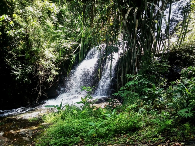
Lake Kenyir – contains 340 small islands, more than 14 waterfalls, several rivers, and rapids. The jungle surrounding the lake is home to some endangered species (tigers, elephants). The place is also a popular area for hiking, canoeing, sailing, rafting, etc.
Malaysian peninsula (11 states and 2 federal territories)
- Countries + capital cities: Johor Bahru, Kedah (Alor), Kelantan (Kota Bharu), Malacca (Malacca), Negeri Sembilan (Seremban), Pahang, Penang, Perak Perlis (Kangar), Selangor (Shah Alam), Terengganu (Kuala)
- Federal territory + capital cities: Kuala Lumpur (Kuala Lumpur), Putrajaya (Putrajaya)
- Neighboring countries: Thailand (north), Singapore (south), Indonesia – Sumatra Island (Malacca Strait)
- The mountainous region in the north, the lowlands are in the south
- The monsoon period is far more pronounced on the eastern side of the peninsula than on the west. The most prominent rain season on the West Coast is between September and November.
- West Coast Islands: Langkawi, Penang, Pangkor, Payar, Ketam, Sembilan, Angsa, Pisang
- East Coast Islands: Perhentian, Redang, Tioman, Tenggol, Kapas, Lang Tengah
Straits of Malacca – is named after the city of Malacca, which was formerly the capital of Malaysia and also is a very important historic harbor. The strait is one of the most important traffic arteries in the world. It transports almost 1/4 of the transported goods and 1/4 of the oil. But there is a big problem with the piracy too. There is a new idea of the construction of the Thai Canal through, which would link the Andaman Sea and the Gulf of Thailand, was also considered. The main initiative of the project was gradually taken over by China, which currently includes it in the so-called New Silk Road Project.
Borneo Island (2 states and 1 federal territory)
- The 3rd largest island in the world
- The Indonesian name of the island is Kalimantan
- Countries + capital cities: Sabah (Kota Kinabalu), Sarawak (Kuching)
- Federal territory + the capital city: Labuan (Victoria)
- Neighboring countries: Brunei (north), Indonesia (south), Philippines (Sulu Sea)
- Swampy coastline and high mountains in inland
- The smaller islands: Lankayan, Selingan (Turtle Island), Mataking, Sipadan, Mabul, Kapalai, Layang Layang, Tunku Abdul Rahman Marine Park, Labuan
Formerly, it was mostly rainforest, but nowadays rainforest is endangered by rapid deforestation for palm oil plantations. With this case, the life of many endemic species of animals and plants (orangutan Bornean, Sumatran rhinoceros, elephant, the largest flower in the world of Rafflesia ….) are endangered too.
It is very difficult to determine the character of the weather. It depends on the currents of the seas (the South China Sea, Sulu sea and Sulawesi sea) and monsoons are very important too. Rain can come at any time of the year and is not uncommon when the weather turns 360 degrees in a few minutes. The difference between the so-called dry and rainy season is more pronounced in the Sabah (the driest months are December and January). In Kuching and in the interior of Sarawak, there is the most rainfall from all over Malaysia.
Mount Kinabalu – is the highest point of Malaysia located in the Sabah area of the Kinabalu National Park. It is in the UNESCO World Heritage Site. Mountain is one of the most important biological sites in the world. There are plants of Himalayan, Australian and Indomalian origin. In the winter, temperatures vary from -4 to 8 ° C and in the summer months from 3 to 12 ° C
When to Go to Malaysia?
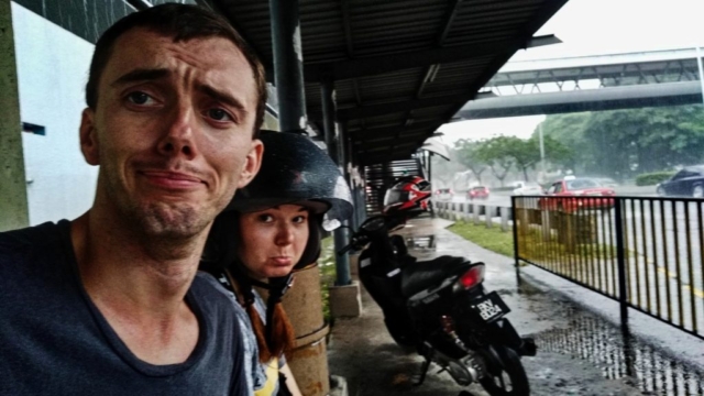
With the weather in Malaysia, it’s like playing a lottery. We were in Malaysia in “dry” and “rainy” season, and sometimes the weather was exactly the opposite, so I think it’s better to count with both options and adjust the program with the actuall weather. When it is beautiful and the sun shines, it is perfect to go to the beach. Conversely, if you want to go out on a trip, I do not think there is a big disaster if the weather is cooler and there will be some rain showers. It is good to take a light jacket. For local peoples, it is a so-called mandatory gear, so they are never suprised. Remember for that, especially if you rent a scooter. In our case, we were suprised by the rain two times. But if you decide to go on a jungle or mountain trek, there is more a lower temperature, and if the rain gets stronger, the best decision will be, if you will not continue in this adventure.

